Our first day of travel from Petaluma, CA to Vancouver, BC was our worst. We took I-5 and, despite keeping the A/C on recirculate and me being on oxygen, I got pretty sick from the pesticide exposures driving past all the agriculture. Miriam was in even worse shape. Screaming, tantrums, and two episodes of extreme potty messiness.
So we were really looking forward to our planned lunch time stop. Mt Shasta, just east of Mt Shasta City, which is past all the bad I-5 air. A couple people recommended stopping at the health food store there, Berryvale, but we never saw it. The town has several blocks of stores (and looked pretty interesting).
Once on the road, I realized I’d forgotten to put directions to the mountain on my palm. Fortunately, it was on my map. We took the first exit into town (should have taken the second, more northern, exit) and followed the signs to the visitor center. The folks there were nice and the building was tolerable and reasonably scent-free. The restrooms had a slight scent but I did not need my mask for the short time inside. We got a street map of the town with directions to Panther Meadows.
A friend told us “Panther Meadows in August is something not to be missed. The flowers, the fresh air, the streams, etc. are pretty spectacular…it is only a few hundred feet from the parking lot, so even kids can do the walk.”
I definitely feel like we missed something. The drive to Panther Meadows was easy enough, and we had no problem finding it, but we saw nothing special.
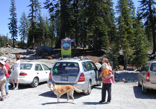
Panther Meadows
This was it. A small dirt parking lot, with some campsites a few feet away up the hill, lots of rocks, and a few trees.
We were all tired and cranky and starving and I had a splitting headache. But there was no place to sit down, let alone eat. The picnic tables were for the campsites, and they were all full. We were told there was a one mile loop trail through the meadow; we saw what might have been a trail head, but nothing was marked. We asked, but no one seemed to know where the trail or the meadow was. I asked about the wildflowers and people just shrugged.
One arriving camper came over and said we were in the wrong parking lot. That if we went a bit further, we’d get to the Panther Meadows day use lot and that it had picnic tables. And that there were other areas with tables too.
There was no other Panther Meadows area. We passed what must have been the meadow (with no way to drive in) but no there were no wildflowers. It was hot and dry and most of the non-tree plants were dormant. It was a lot cooler on the mountain than in the valley. Along I-5 our outdoor temp gauge read 103. But it quickly dropped to 80 as we climbed.
We passed a lone picnic table or two. In the sun with nothing around. We went to the end of the road and found several tables. Still in full sun with rocks and the occasional tiny shrub hanging on for dear life. But there was a nice breeze.
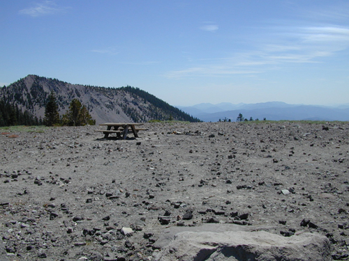
Picnic table on the top of Mt. Shasta
We were nowhere near the top of the 14,162 mountain, but we were well above the 7450 feet of Panther Meadows.
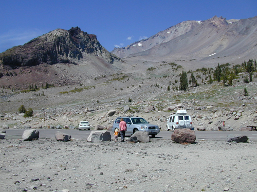
Looking at the top of Mt. Shasta from uppermost parking area
The road up was a very easy drive, despite the elevation change.
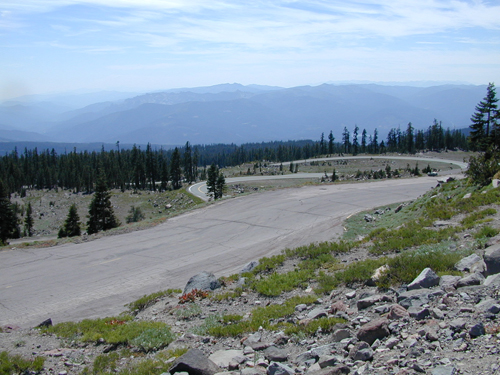
Road leading up Mt. Shasta
We had a lovely picnic, though my headache deepened, along with weak muscles that came out of nowhere, and I realized I was suffering from altitude sickness. It stayed with me until we’d been off the mountain for a few minutes (the base headache was freeway exposures and lasted all day). Mt. Shasta City is at 3500 feet, which is low enough to avoid discomfort.
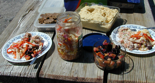
Picnic lunch: raw vegetable salad, banana nut bars, hummus, fish salad, and roasted vegetables
As we left to continue our trip, we passed Panther Meadows and stopped at the Bunny Flat (6900′) trail head to use the bathrooms (adequate, no water).
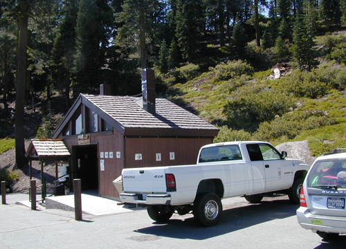
Bunny Flat Restrooms
We made our way back to the freeway and headed north to Oregon for the night.
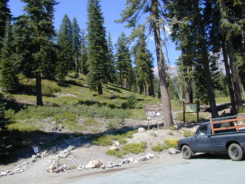
Bunny Flat Trail Head
After this visit, I just assumed my friend was mistaken about August being wet enough for flowers. Reading the various web accounts about Panther Meadows though, it seems it’s a special spot. I’m not sure if the flowers persist through the summer, but many people mention the streams.
Had I known more about it, I would have found an easy access picnic spot (perhaps in town) then gone to Panther Meadows for an after-lunch hike. Though there wasn’t much I could have done about the altitude sickness, being fed and rested would have given us the wherewithal to explore the area and find its treasures.
Links:
- Sacred Spring: Panther Meadows on Mount Shasta (Peggy Vincent’s description of the area)
- Recreation in and around Mt. Shasta (Mt. Shasta Chamber of Commerce and Visitor’s Bureau with lists of day hikes and other information)
- Mt. Shasta Area – Campgrounds


1 response so far ↓
1 Yorick // Sep 29, 2008 at 12:22 pm
There were loads of wildflowers in August 2006. The whole meadow is feed by streams of snow melt.
I’ll send you photo’s. A better bet would have been to picnic in town and then go for a hike. I don’t think they make it easy for people to find as it is a sacred place for the Native Indians. Great for a quiet hike, not the place for a picnic. Probably fantastic for meditation.
Leave a Comment